The seven worth planning a day around
Thirty viewpoints is too many for one trip. These seven cover every kind of view the island has, a summit above the clouds, a glass cliff, a crater, a levada balcony, a laurel forest, an ocean headland and a quiet local pass, and between them they only need three days of driving.
1,818 m · the highest point you can drive to
Madeira's third-highest peak and the only summit with a road to the door. The last 6 km of the ER202 climbs through the laurel line into bare volcanic rock; above roughly 1,400 m you usually break through the cloud deck. The platform, radar dome and café are all within 200 m of the car park. Come at sunrise for the mar de nuvens (sea of clouds), which forms on roughly six mornings in ten, and bring a fleece, it runs about 10 °C colder than Funchal all year.
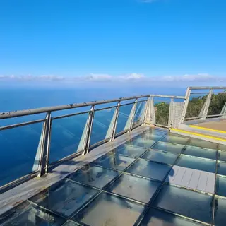
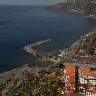
580 m · glass floor over Europe's highest sea cliff
A glass-floored platform bolted to the cliff edge above Câmara de Lobos, looking straight down onto the Fajãs dos Padres terraces and the fishing boats. Free, step-free, open every day, with a paid car park and a cable car that drops to the fajã farms below. Best in the morning, when the sun is behind you and the sea is lit; by late afternoon you are shooting into the glare.
1,095 m · straight down into the Nuns' Valley
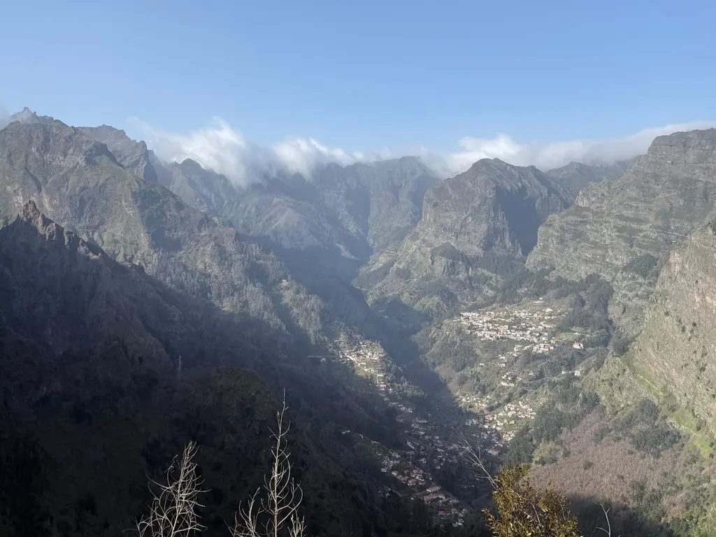
A 500 m uphill path from the car park brings you out on a rock balcony directly above Curral das Freiras, the village at the bottom of an extinct crater ringed by 1,500 m walls. This is the classic cloud-inversion spot after a windy day, the valley fills with white and the peaks stand out of it. There is a hotel, a café and a chestnut-cake shop at the car park.
870 m · an easy levada walk, no head for heights needed
The gentlest big view on the island: a flat, shaded 1.5 km walk along the Levada do Furado from Ribeiro Frio to a railed balcony facing the Ribeira da Metade amphitheatre and the central peaks. Push-chair-friendly for most of its length, good in light rain, and the chaffinches at the end will land on your hand.
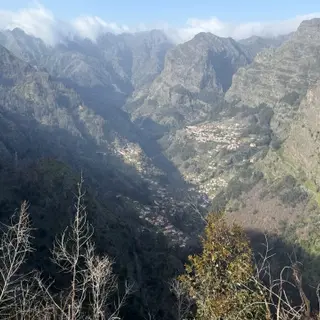
1,005 m · the local alternative to Eira do Serrado
The Lovers' Pass, reached on a narrow road up through the cherry terraces of Jardim da Serra. Same crater, different angle, a fraction of the people, usually a couple of cars and a picnic table. It is also the start of the old mountain path over to Curral das Freiras.
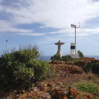
180 m · the raw east-coast headland
On the São Lourenço peninsula, a five-minute walk from the road to a viewpoint over red-and-ochre cliffs, the Ilhéu do Farol and the wind-scoured spine of the east. Completely different geology to the rest of the island, dry, treeless, volcanic, and often sunny when the centre is capped in cloud.
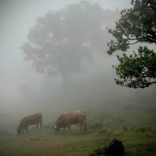
1,150 m · ancient laurel trees in the mist
Less a viewpoint than a plateau of 500-year-old til trees that appear and disappear in the fog rolling off the north coast. The photographs everyone recognises need mist, so paradoxically this is the place to drive to when the weather is poor. Cattle graze the meadow; keep back from the animals and stay on the tracks.
How to pick the right viewpoint on the day
The single most useful habit on Madeira is to check the cloud base before you leave, not the forecast for "Madeira". Our live weather by parish and the mountain webcams tell you in about ten seconds whether the peaks are clear. Three rules cover almost every day of the year:
- South coast grey, peaks clear: drive up. Pico do Areeiro, Ninho da Manta, Bica da Cana and Achada do Teixeira will be above the inversion in sunshine, with a white floor stretching to the horizon. This is the best-looking weather Madeira produces and it happens most often between November and March.
- Peaks capped, coast clear: stay low and go east or west. Ponta do Rosto, Pico do Facho, Ponta do Pargo and Miradouro do Guindaste are all under different weather to the centre, and the light on the cliffs after a rain shower is worth the drive on its own.
- Everything in cloud: go to Fanal. The whole point of that forest is the mist, and a washed-out day is the day the ancient til trees look like the photographs.
Driving, parking and how long each one takes
Nearly every miradouro on this page has a car park at the door, and none of them charge for entry. The drive is the hard part rather than the walk: the mountain roads are steep, well surfaced and full of hairpins, and the last stretch to places like Boca dos Namorados or Bica da Cana narrows to a single lane with passing places. Take it slowly, use first and second gear on the descents to save your brakes, and be prepared to reverse: the local convention is that whoever is closer to a passing place backs up.
Allow 20–30 minutes at a roadside viewpoint, an hour at Cabo Girão or Eira do Serrado with the walk and a coffee, and half a day for Pico do Areeiro if you want the sunrise. Car parks at Areeiro and Cabo Girão fill by mid-morning in July and August; the rest of the island's viewpoints almost never do. See the full driving in Madeira guide for tunnels, fuel and parking rules, or the transport guide if you are travelling by bus.
What "miradouro" actually means here
Miradouro is Portuguese for a place to look out from, and on Madeira it is a formal designation rather than a loose description. A miradouro is signposted from the road, maintained by the parish or the regional government, railed at the edge, and very often has a kiosk, a picnic table or a small café. That is why the island has so many: as the road network was rebuilt through the 1990s and 2000s, viewpoints were built into the design at the points where the old roads used to stop for the view.
A handful of the entries on this list are not strictly miradouros, Pico Ruivo and Achada do Teixeira are trailheads and summits, Fanal is a grazing plateau, and Balcões is the end of a levada. We include them because they deliver the same thing: a view you would plan a morning around.
Sunrise, sunset and the cloud sea
- Sunrise: Pico do Areeiro, arrive 30 minutes before sunrise. Above the clouds on roughly 60% of mornings.
- Sunset over the cliffs: Cabo Girão (glass floor) and Véu da Noiva on the north coast.
- Cloud sea ("mar de nuvens"): Eira do Serrado after a windy day, or Pico Ruivo on foot from Achada do Teixeira.
- Quiet alternative: Balcões, a level 1.5 km levada walk for the Ribeiro Frio amphitheatre.
- Stars: Pico do Areeiro and Paúl da Serra have the darkest accessible skies: see our stargazing guide.
Mistakes visitors make
- Driving to Pico do Areeiro in shorts. It is 10 °C colder at the top than at sea level, and windier.
- Trusting a single island-wide forecast rather than checking the parish and the webcams.
- Booking the Areeiro sunrise for the last morning of a trip, if it is clouded in, there is no second chance.
- Assuming Pico Ruivo is a viewpoint you can drive to. It is a 45–90 minute walk from Achada do Teixeira, or a serious ridge hike from Areeiro.
- Skipping the small ones. Guindaste, Espigão and São Cristóvão take five minutes each and are often empty.